Obtaining a ranking of values for each county in São Paulo State using soil variables in an unsupervised problem (factor analysis by principal component analysis (PCA)).
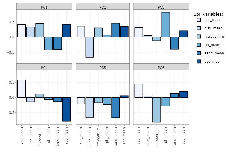
Creating a ranking considering soil variables in factor analysis
PCA
soil properties
factor analysis
rankings
R

Predicting soil clay content using satellite images
Predicting soil clay content using spectral bands of time series images (Landsat) in python.
DSM
clay content
python
SHAP
remote sensing
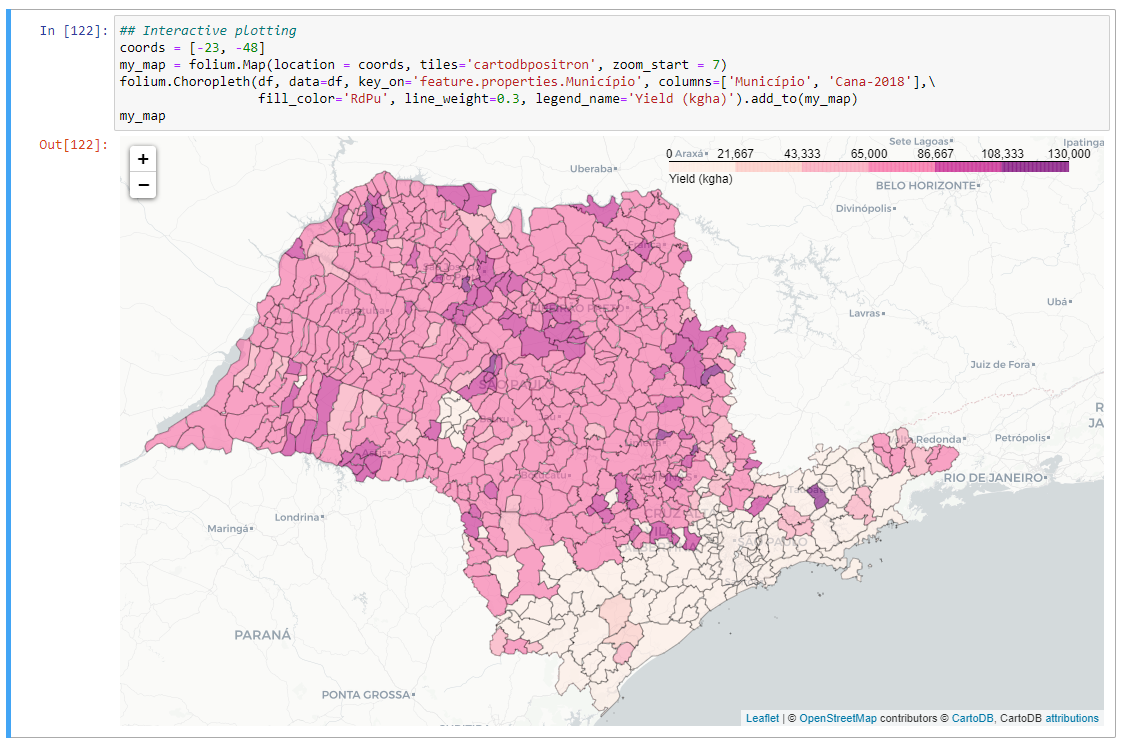
Temporal analysis of sugarcane yield
Getting insights of the temporal variability of sugarcane over a period of five years by municipalities in the State of São Paulo
geoprocessing
spatial analysis
yield
sugarcane
python

Estimating the abundance of soil minerals
Do you know that it is possible to estimate the abundance of specific soil minerals in the soil using soil spectroscopy?
digital soil mapping
machine learning
iron oxides
spectroscopy
R software

WIDS Datathon 2022
My participation in the WIDS Datathon 2022
climate change
data science
energy efficiency
python
jupyterlab

GEE tutorials
My learning path to master Google Earth Engine.
Google Earth Engine
JavaScript
Jupyter Notebook
Python

My first Datathon
My experience participating in a Dathaton.
Jupyter Notebook
Kaggle
GitHub

Different spatial scales
Mapping soil properties using satellite images in different temporal, spatial and spectral resolution.
Landsat-8
Sentinel-2
PlanetScope
Soil management
Pedology

Soil mapping using bare soil images
Digital mapping of soil properties in São Paulo using bare soil images of Sentinel-2 and Landsat-8 images.
Sentinel-2
Landsat-8
digital soil mapping
R programming